The most detailed Earth imagery. Ever.
Powering next-gen applications with standardized and ultra‑high resolution drone imagery.


Powering next-gen applications with standardized and ultra‑high resolution drone imagery.


Imagery products derived from actual Spexi drone imagery

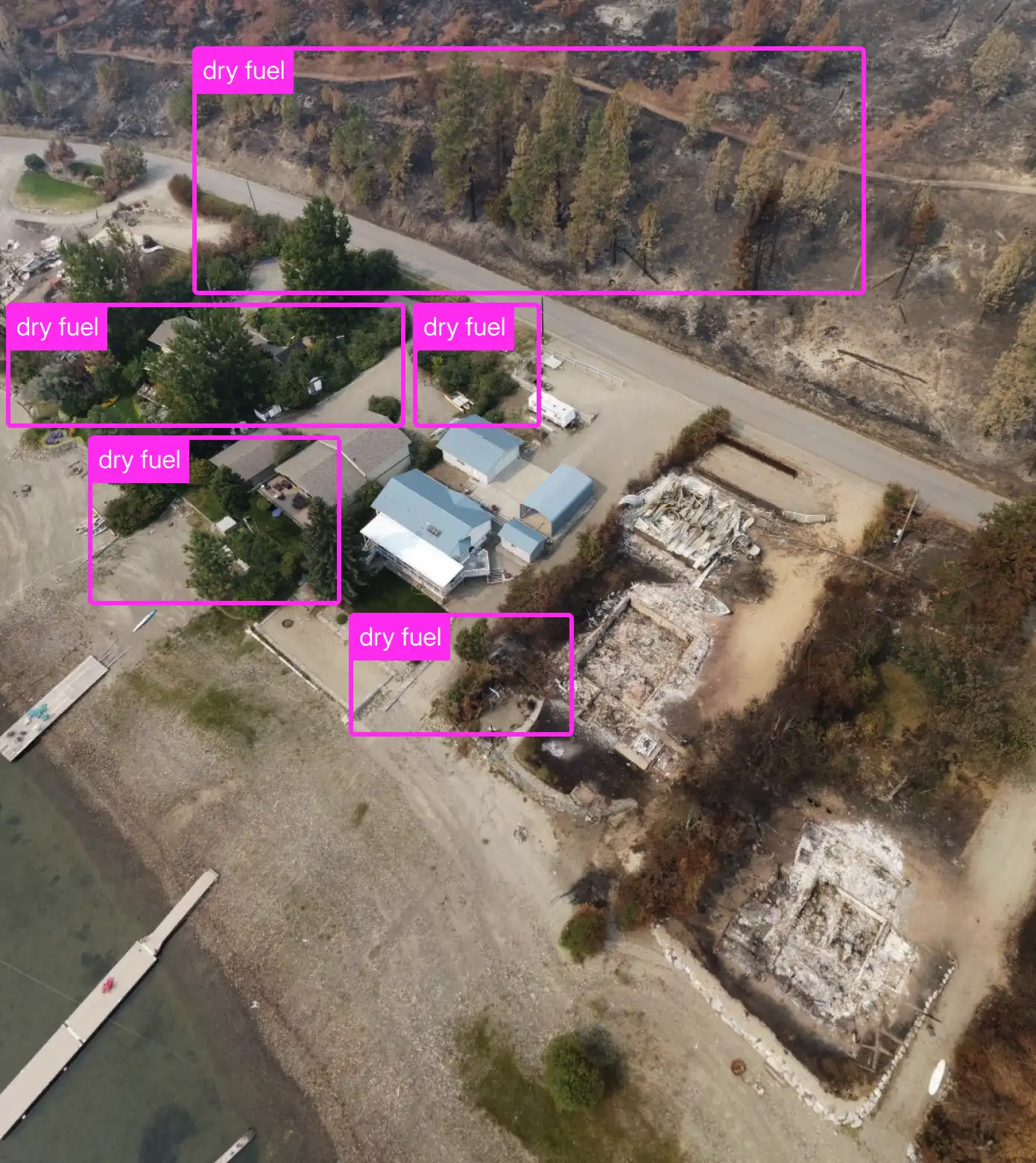
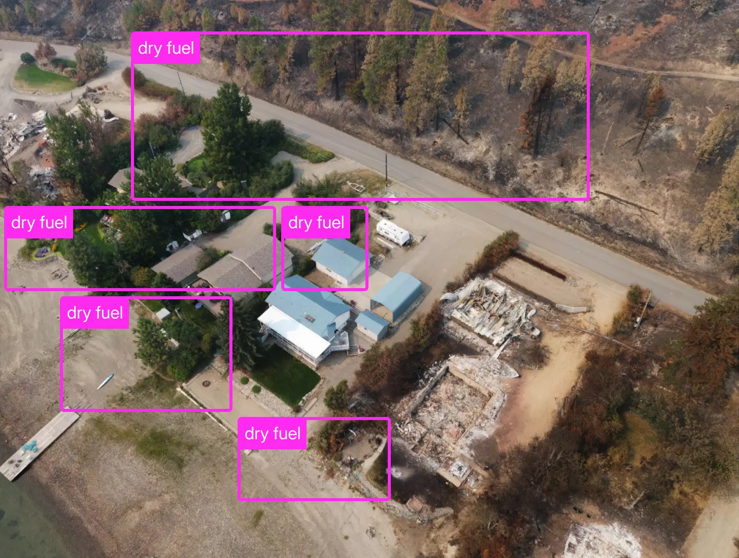
In an emergency situation, having accurate and up to date information is an essential resource for decision makers. Our ultra-high resolution drone imagery can provide first-responders with un-precedented situational awareness before and after an incident has occurred by leveraging the existing supply of drones in the area. We can then apply state-of-the-art computer vision and AI processes to better predict where a wildfire or flood will go before it happens, which results in safer and better prepared communities.
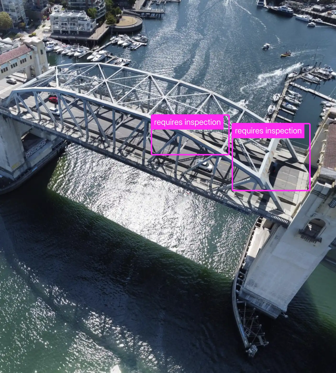
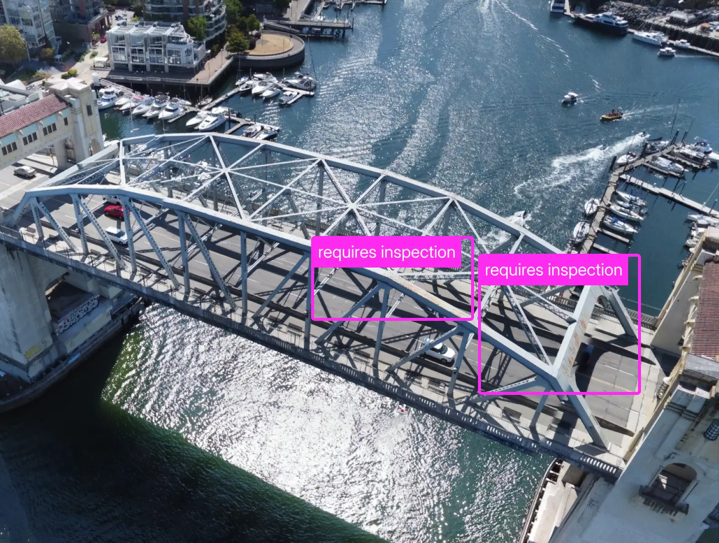
Keeping critical infrastructure like railways, bridges, and roads in good condition is vital to keeping our economies healthy and moving. Our imagery can be used to remotely inspect and monitor the real-world condition of infrastructure saving crews time, money, and improving safety.
In logistics and last mile delivery, the name of the game is speed and accuracy. If drivers cannot quickly find the right door, address, or loading bay, margins quickly start to decrease for operators. The largest of these companies like Uber and Amazon can increase their margins by using our ultra-high resolution imagery products to pinpoint the exact delivery locations.
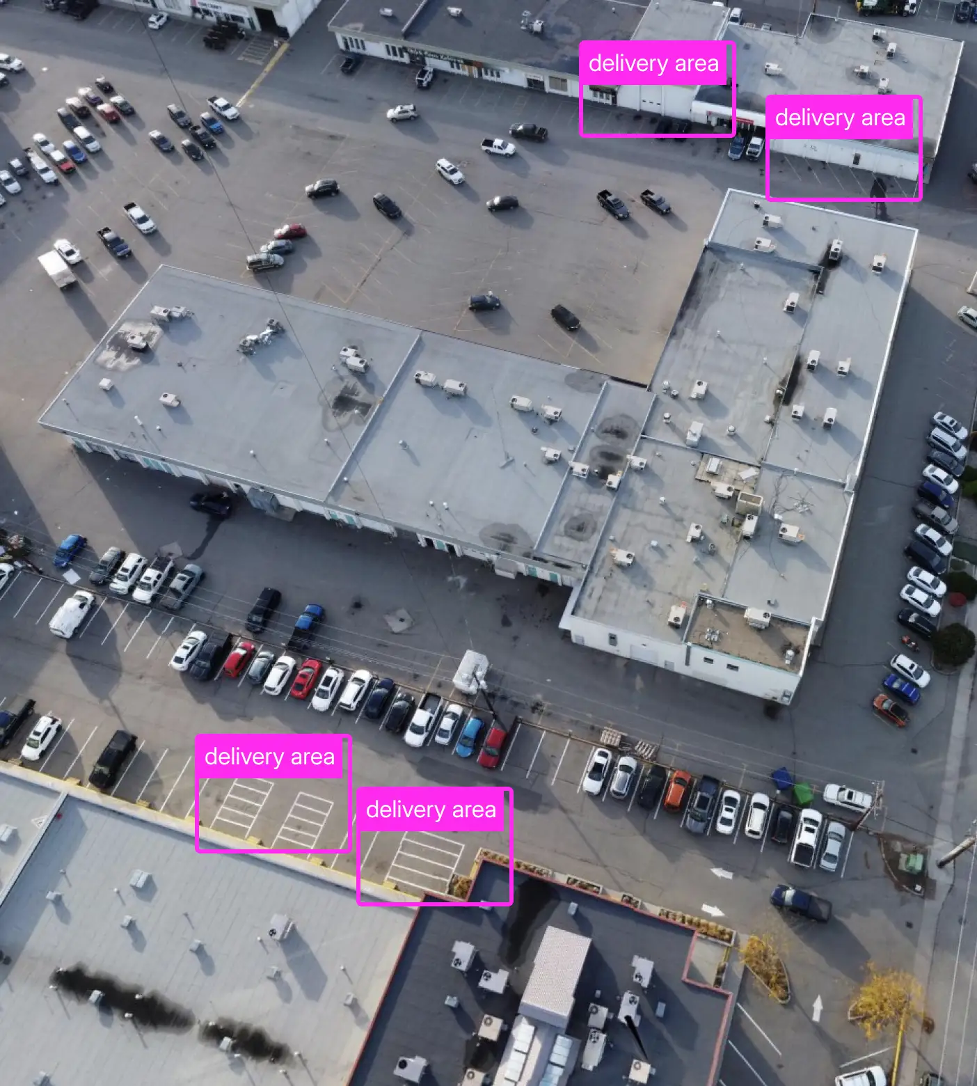
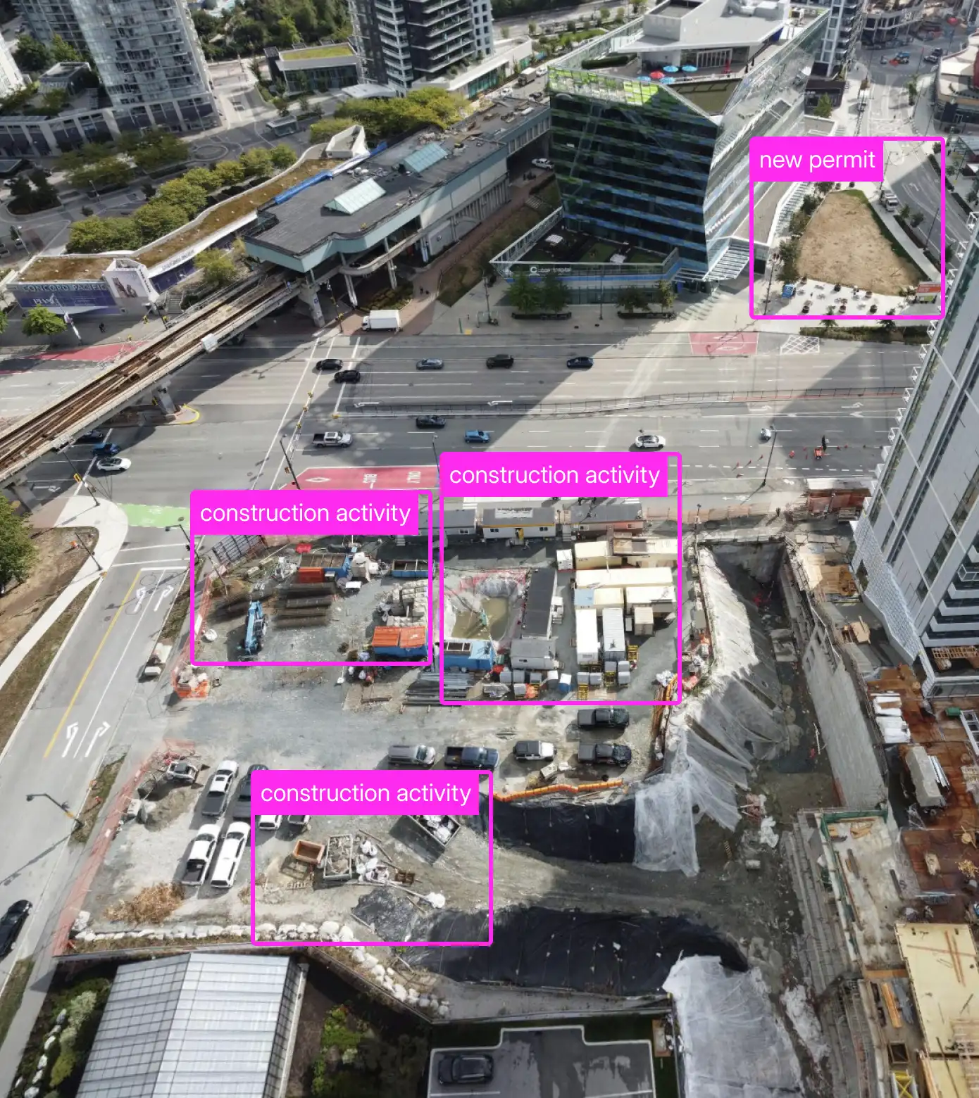
Cities around the world are digitizing their infrastructure at record pace to increase margins and improve experience for their citizens. Frequently updated and ultra-high resolution imagery products pave the way for successful applications like self-driving cars, last-mile delivery services, permitting, vegetation control, parking, real-estate management, and so much more.
Even better, city funds used to pay for the imagery goes back into the pockets of local drone pilots. It's a true win-win.
With the recent explosion of AR/VR, AI, and real-world gaming applications, recently updated and ultra-high resolution imagery is essential. Developers want the ability to re-create our worlds in un-paralleled detail and accuracy. Spexi imagery can enable this new frontier to prosper and expand quickly.
The new AI systems like ChatGPT and Gemini rely on better quality information to train their models. Never before has drone quality imagery been available at scale for these systems to consume. We anticipate incredible new and previously impossible applications to arise when AI meets Spexi imagery at scale.

When a region needs to be imaged, the platform divides it into hexagonal zones called Spexigons.

Drone pilots simply hit “FLY” on our mobile app, and supervise flight as their drones autonomously image the area.

Our imagery viewer & sharing features make it quick and easy to share imagery with stakeholders without the need to set up additional accounts.

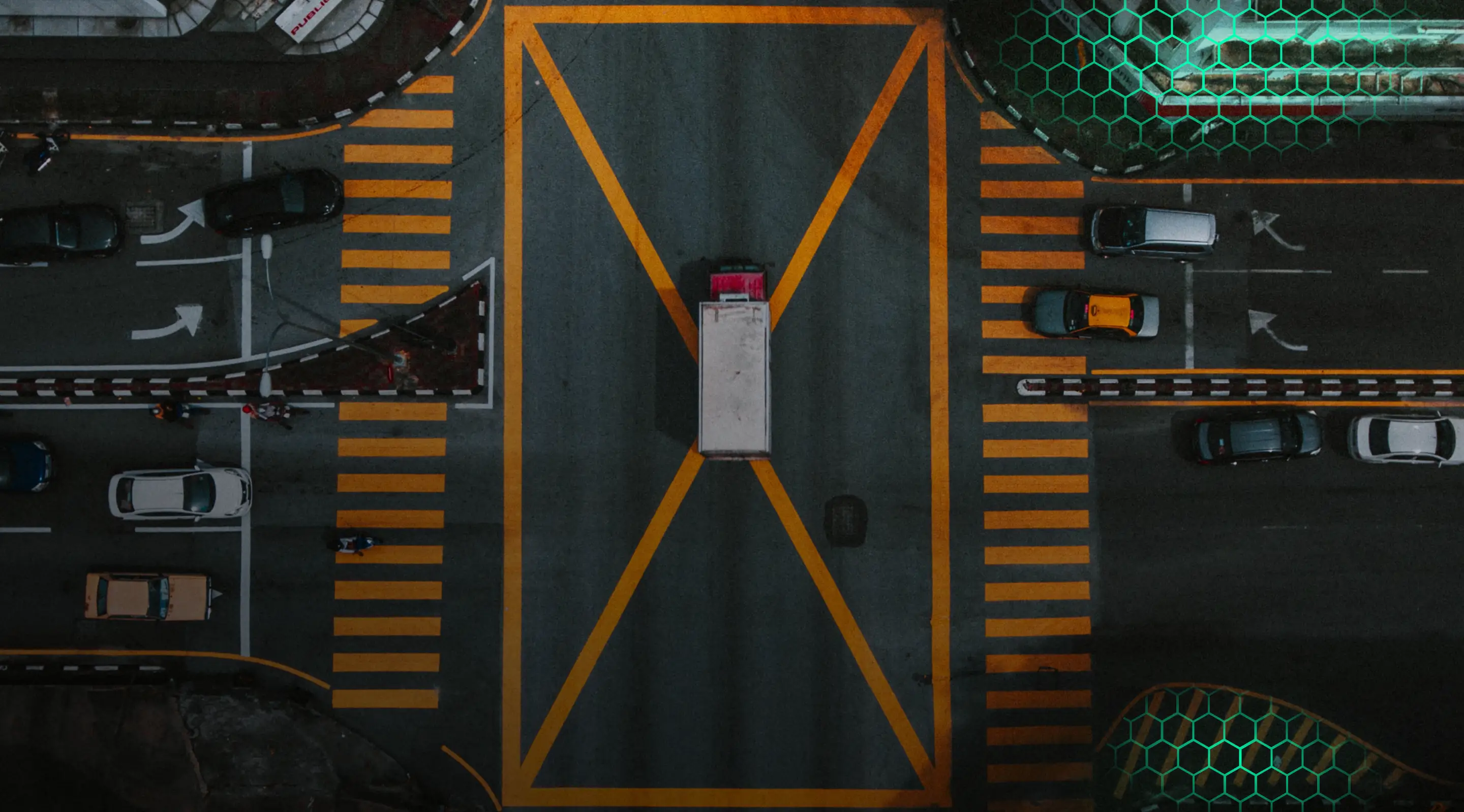
Drones produce imagery 900x more detailed than satellites

The age of AI enables incredible insights to be produced from Earth’s most detailed imagery.

Spexi works exclusively with sub-250g micro drones reducing friction for stakeholders.
The Spexi platform leverages the nascent supply of very small consumer drones to produce incredibly fresh and detailed imagery of our planet.
Our unique mobile app enables drone pilots to contribute standardized and perfect imagery whenever and wherever you need it.

The first solution of its kind for crowdsourced and standardized aerial imagery capture.


Do you want to earn rewards with your drone? Our FLY-TO-EARN mobile app controls your drone autonomously and captures perfect imagery every time. All you have to do is monitor the airspace for safety. It's that simple.